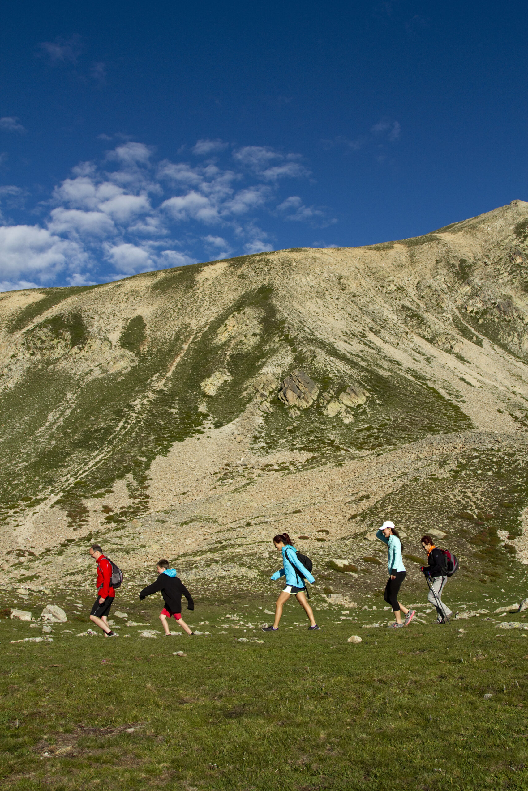
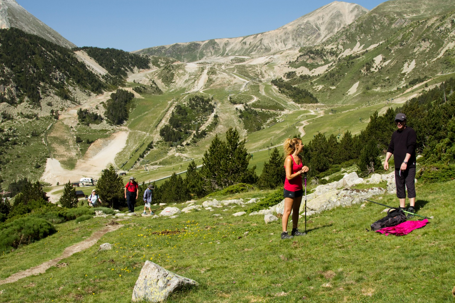
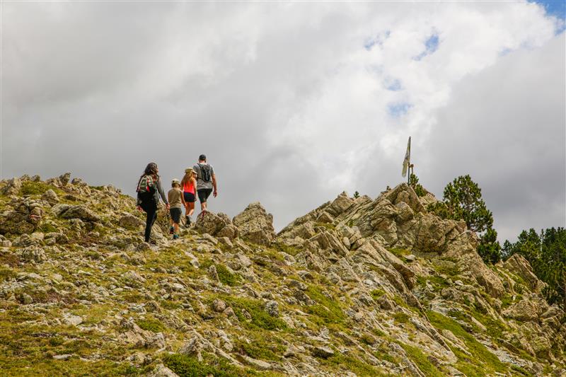
Summer in the mountains presents the perfect setting for family hiking. And in the case of Vallter, the area could not be more suitable to carry out this activity, as it has routes of difficulty levels for everyone.
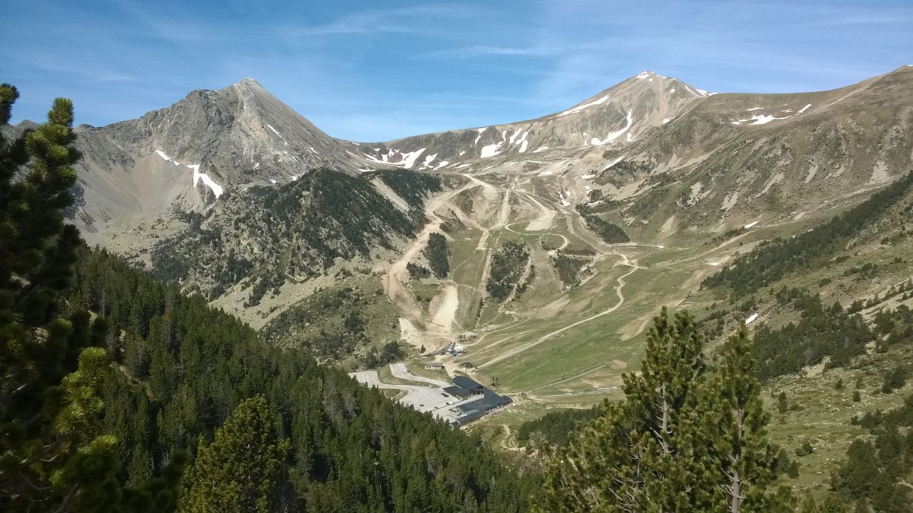
The Vallter station is located in the circle of glacial origin of Morens – Ull de Ter, a situation that allows you to enjoy the unique and exceptional landscapes of the Pyrenees.
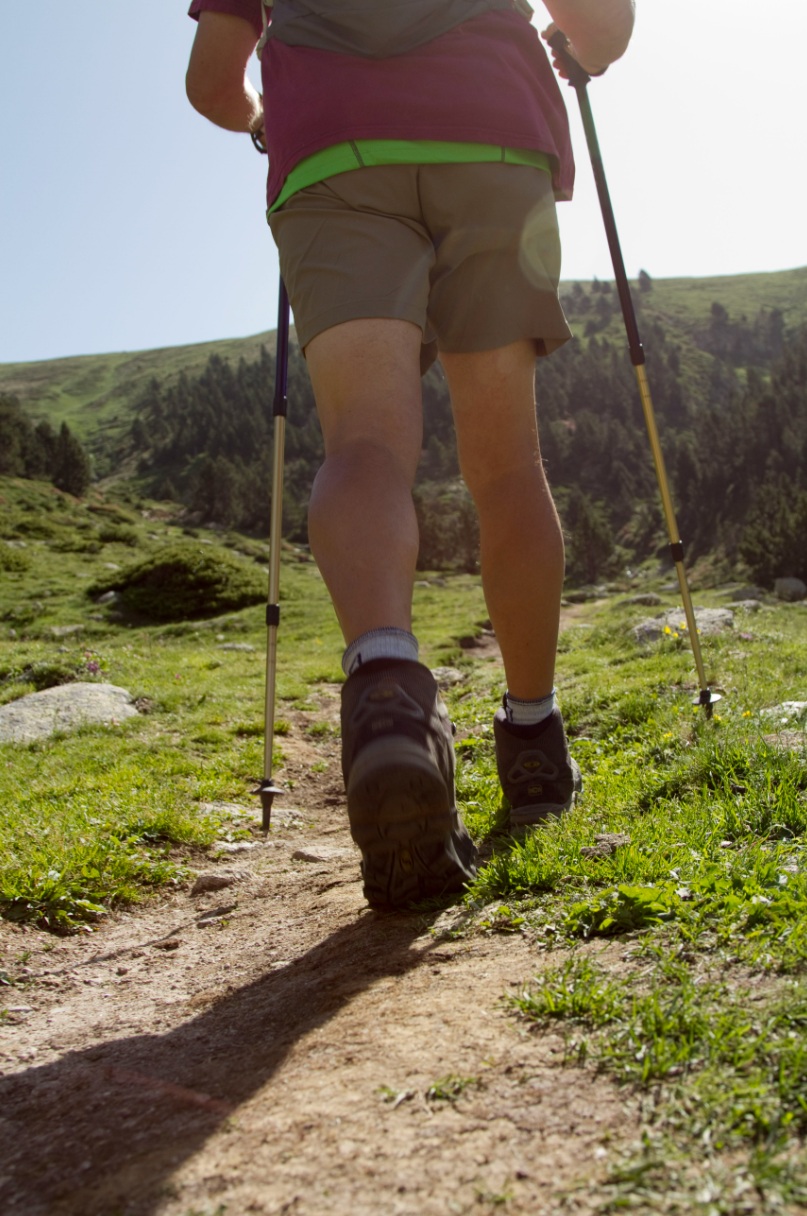
It is recommended to wear appropriate footwear and clothing for mountain activities, as it must be borne in mind that you are in high mountains. Weather changes can occur in a very short space of time, it is recommended to check the weather conditions in advance. It is everyone’s responsibility to know the unforeseen events that may arise during the excursion.
The hiking trails that can be done around Vallter are suitable for adults and children, with low-medium difficulty. A map with marked itineraries is provided.
1.Hiking trails with departure from the height of 2.535 J. Pujol chairlift
Viewpoints Route – Low level
Negative elevation: 400 m
Approximate distance: 3 km
Estimated duration: 1’15 h
From the arrival of the chairlift, we take the path on the left, just behind the skiers’ hut. The first stop is at the Font del Ter, located at an altitude of about 2,500 m. This spring is the visible origin of the waters that, coming from the melting ice and underground seepage, give rise to the Ter River. Following the path, we enjoy the views of the majestic north face of the Gra de Fajol until we reach the Birth of the Ter River, where it emerges again naturally and continuously, before embarking on its long journey to the Gola del Ter, on the Costa Brava. A little further down we find the ruins of the first mountain refuge in Catalonia, a testament to the hiking history of the area. We continue towards the Mirador del Puig dels Lladres, with unique views over the Ulldeter cirque, the valley, the current Ulldeter refuge and the slopes of the resort. The descent continues along the Barquins track and briefly enters a forest of black pine and black spruce. Finally, we arrive at the base of the resort, where a well-deserved rest awaits you.
Water Route – Low level
Negative elevation: 420 m
Approximate distance: 3,5 km
Estimated duration: 1’30 h
This route shares the first section with the Ruta dels Miradors to the Mirador del Puig dels Lladres, but from here it takes an alternative itinerary to discover the course of the water that supplies the resort. We divert along the Estadi track towards the Morens stream, where we can observe the natural path of the water before reaching the collection lake, a key infrastructure for the water supply in both summer and winter, and for snow production. The route continues along a path that passes by a beautiful spring (name pending confirmation) and continues until we reach, again, the base of the resort.
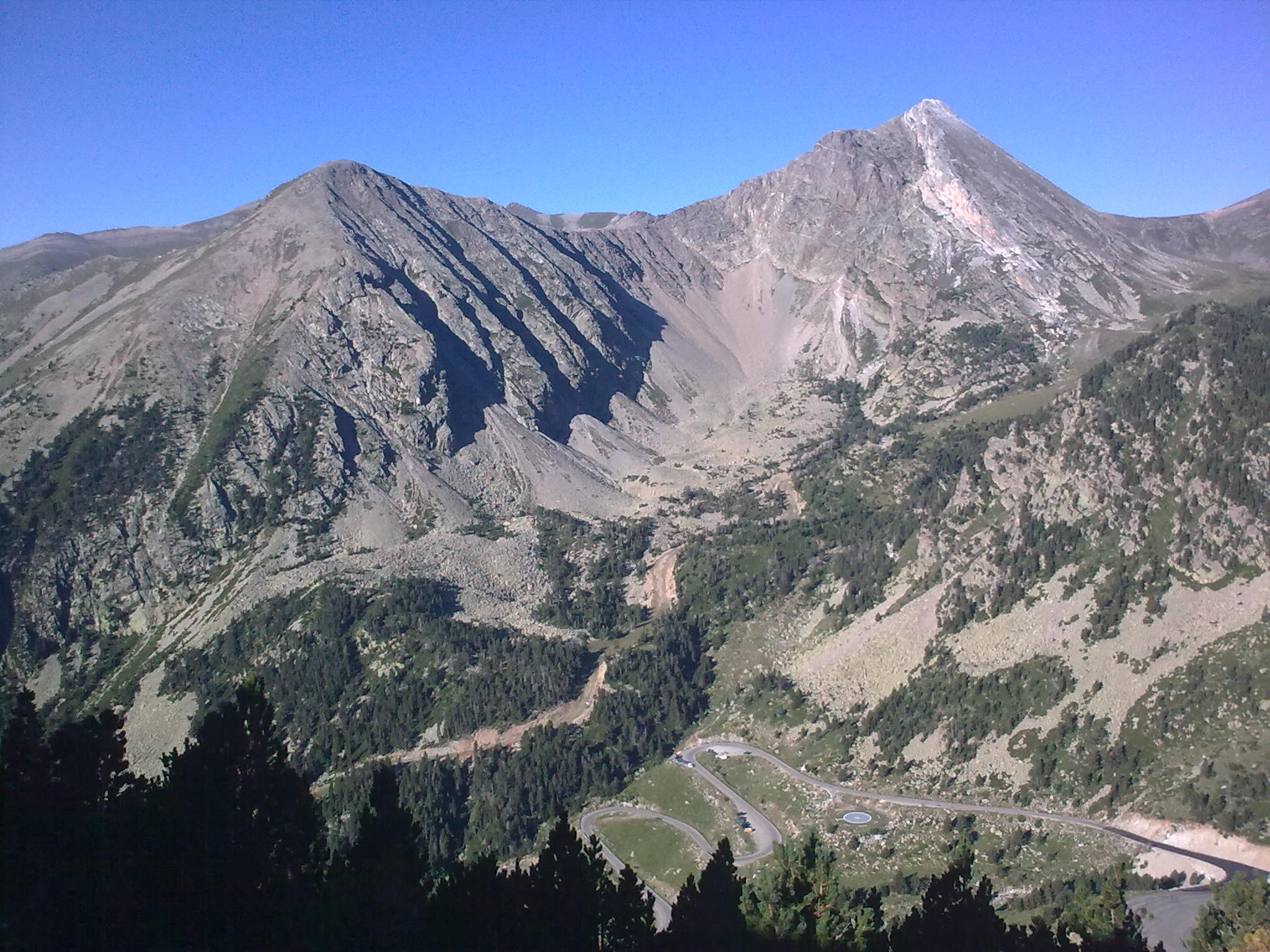
Coll de la Marrana and Bastiments (2874m) – Medium level
Elevation gain: 340m
Length: 1650m
Estimated duration: 1’30 h
After the arrival with the chairlift, follow way to the source of the River Ter. Following the GR11 up to the Coll de la Marrana. Once there, turn right and start climbing the Bastiments until you reach a point where the rise is already steeper. We continue up to the first cross and heading west to reach the top of Bastiments peak. From the top you can see Bacivers lake and ponds Coma Mitjana and if you look west, you will see Freser peak and peak of Infern.
Coll de la Marrana and Gra de Fajol (2708m) – Medium level
Elevation gain: 175m
Length: 2300m
Estimated duration: 1’30 h
After the arrival of the chairlift, follow way to the source of the River Ter below the GR11 up to the Coll of the Marrana. Once there, turn left (south) and follow the path that leads to the Gra de Fajol peak. Once at the top, the view of Bastiments area and Vallter are spectacular. At the east, there is the small Gra de Fajol peak, which is accessible by following the ridge.
2.Hiking trails with departing from the base station (parking 2.100)
Portella of Mantet (2400m) – Low level
Elevation gain: 248m
Length: 2000m
Estimated duration: 1’30 h.
We leave from the restaurant building at the right to direct us towards the NE up the portella. When we get to the Pla de la Portella continue heading northeast to find the torrent or Clot de la Portella that take us to Portella de Mantet at 2411m just at the France border. Looking east, you can see the emblematic peak of Canigou.
Tour of the Pic de la Dona (2704m) – Medium/hight level
Slope: 575m
Length: 7’5km
Estimated duration: 2’30 h
Circular route around the cirque of Morens and Pic de la Dona. The route climbs up to the Portella de Mantet, natural step towards Conflent and ridge up to the Pic de la Dona and his twin peak Bacivers. The return is done by the width of the neck down to the bottom of the cirque of Morens currently are the ski slopes of Vallter. During the tour is very easy to see chamois, marmots and vultures among other animals of the high Mountain fauna.
3.Waypoints
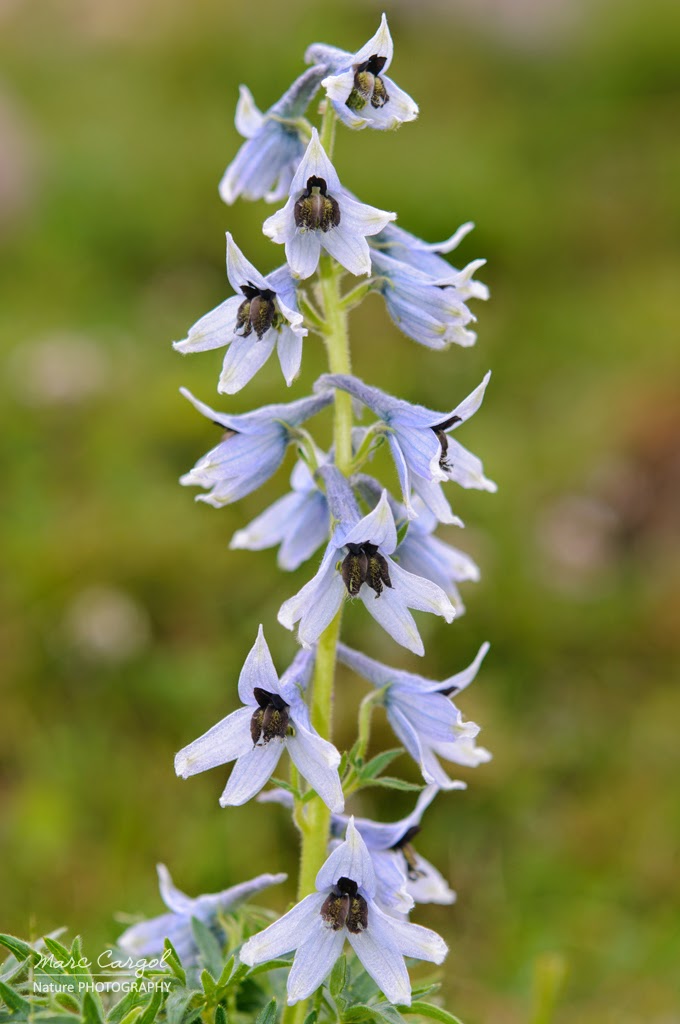
L’esperó muntanyenc (delphinium montanum)
It is an endemic plant that in Catalonia is listed as threatened. The known population of this species is Ripollès stream Morens (Vallter).
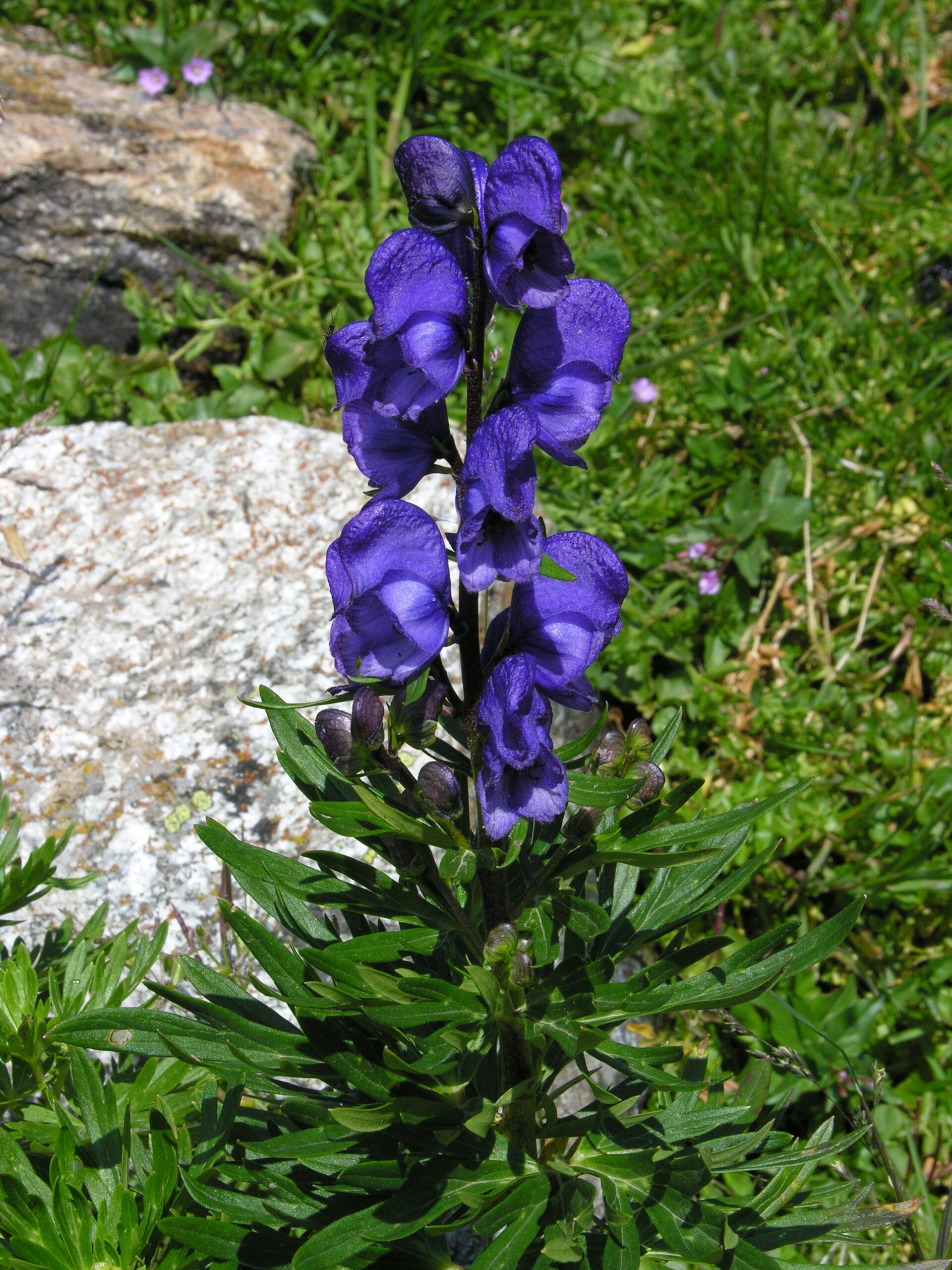
Tora blava (Aconitum napellus)
It is considered the most toxic plant in Europe and can be found in abundance in the Pyrenees. A plant very beautiful but very dangerous. Look at it but not touch!!
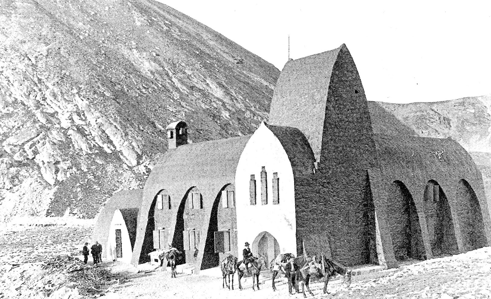
Antic Xalet d’Ull de Ter
Open 25 July 1909 is considered to be the first mountain refuge in Spain. In nineteenth-century style, dynamited by the Franco troops during the civil war so that there no shelter for the maquis.
Cirque of Morens
It is framed by the Pic de la Dona to the east (2704 m), the Bastiments (2881 m) to the north, and Gra de Fajol in the southwest. These are separated by Coll de la Marrana (separating the Gra de Fajol ans Bastiments), which gives access to the valley of Freser on the other side.
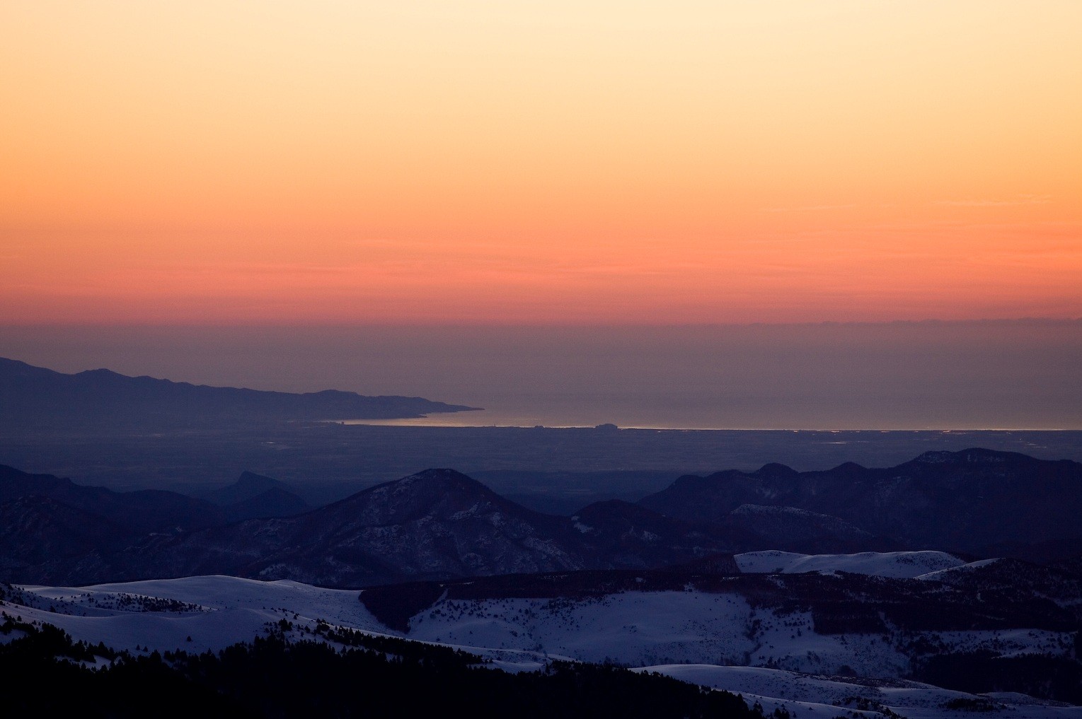
Lookout Point—Balcony of the Costa Brava
On days with good visibility, it offers a unique and exceptional panoramic view of the coastline and the Bay of Roses (Costa Brava).